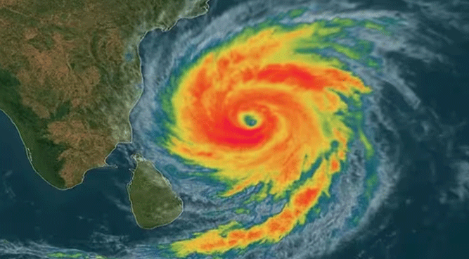
Bhubaneswar: The Cyclonic Storm “Montha” over the westcentral Bay of Bengal is rapidly intensifying and is very likely to cross the Andhra Pradesh coast as a severe cyclonic storm during the evening or night of today, October 28, 2025. Authorities in both Andhra Pradesh and Odisha have launched extensive preparedness and evacuation efforts to mitigate the potential impact.
Eight southern districts of Odisha are on high alert for extremely heavy rainfall and strong winds due to the peripheral impact of the cyclone.
Koraput, Malkangiri, Rayagada, Ganjam, and Gajapati—have been mapped as red zones and are expected to face extremely heavy rainfall and strong winds due to the peripheral impact of the cyclone. Evacuation drives have begun in vulnerable areas, with NDRF and ODRAF teams deployed.
As of 0230 hrs IST on October 28, 2025, the Cyclonic Storm Montha was centered over the westcentral Bay of Bengal, near latitude $14.4^{\circ}\text{N}$ and longitude $83.3^{\circ}\text{E}$. It was located approximately 230 km south-southeast of Machilipatnam and 310 km south-southeast of Kakinada, Andhra Pradesh.
The storm is likely to continue moving north-northwestwards and intensify into a severe cyclonic storm by the morning of October 28. It is then very likely to cross the Andhra Pradesh coast between Machilipatnam and Kalingapatnam, near Kakinada, during the evening or night of October 28. At the time of landfall, the storm is expected to have a maximum sustained wind speed of 90-100 kmph, gusting to 110 kmph.
Fishermen have been strictly advised not to venture into the Bay of Bengal until October 29. Residents in the affected areas are urged to remain indoors and heed all official advisories from local authorities and the IMD.


